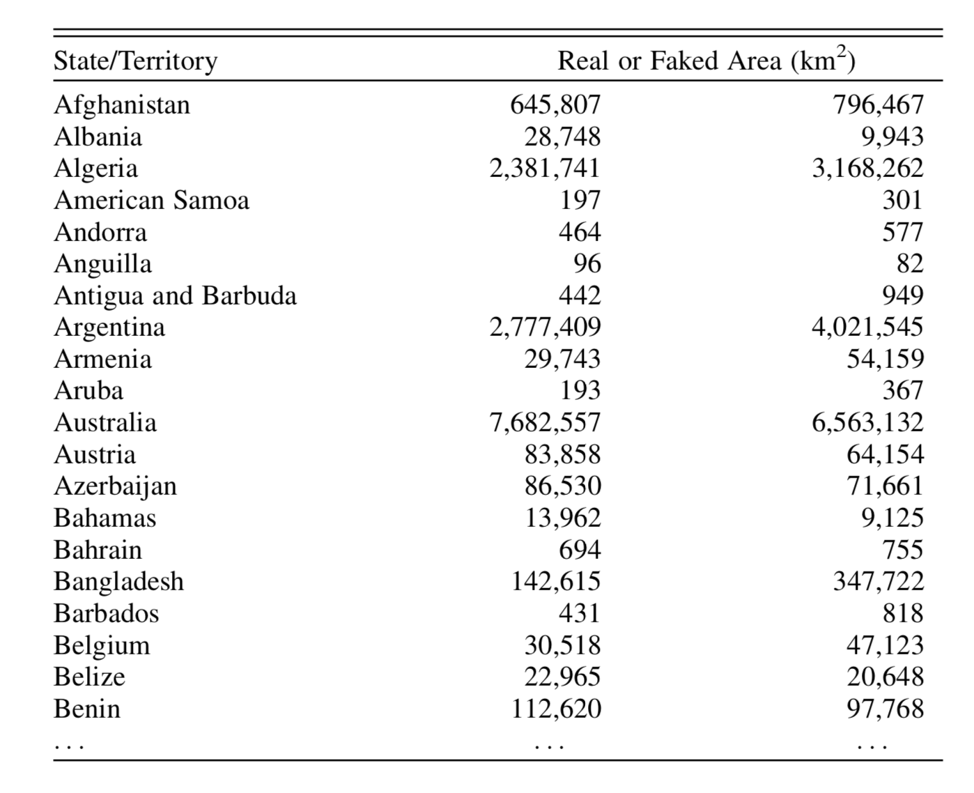
Take a look at the following table:

It shows the total land area, in square kilometres, for various countries. Actually, it’s the first part of a longer alphabetical list of all countries and includes two columns of figures, each purporting to be the corresponding area of each country. But one of these columns contains the real areas and the other one is fake. Which is which?
Clearly, if your knowledge of geography is good enough that you know the land area of Belgium – or any of the other countries in the table – or whether Bahrain is bigger than Barbados, then you will know the answer. You could also cheat and check with Google. But you can answer the question, and be almost certain of being correct, without cheating and without knowing anything about geography. Indeed, I could have removed the first column giving the country names, and even not told you that the data correspond to land areas, and you should still have been able to tell me which column is real and which is fake.
So, which column is faking it? And how do you know?
I’ll write a follow-up post giving the answer and explanation sometime soon. Meantime, if you’d like to write to me giving your own version, I’d be happy to hear from you.
